Construction Services

Mapping
Track construction progress and compare to specific points in time with high resolution orthomosaic imagery captured at subcentimeter accuracy.
Analysis
Verify build counts or measure site material via cut/fill or stockpile analysis.

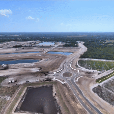
IMAGERY
Explore and share progress through aerial photography and video, or with interactive panoramas. Our technology enables the repeat capture of exact locations over time.